Destinations, Distances & ETAs
Overview
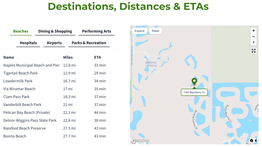
Our Listing Pages and Community Pages have a dedicated section called Destinations, Distances & ETAs. This is a Naples Abodes exclusive site feature that shows you the location of communities and for sale listings on a map alongside over 40 top local destinations. We then show the actual driving distance and ETA to/from the destination using both real-time and historical driving data.
Please see a screenshot of our Destinations, Distances & ETAs below.
Please know that the map can be expanded via the Expand button in the upper left corner of the map. This will expand both the map and list of destinations to a fullscreen view.
Destinations
All destinations are listed by category. There is a clickable category tab each for Beaches, Dining & Shopping, Performing Arts, Hospitals, Airports, and Parks & Recreation. Within each category you will find multiple destinations. Clicking directly on any destination will highlight the fastest route by automobile on the map.
Below, please find all destinations we include sorted by category. For details on these destinations and more, please see the Destinations chapter of our Naples Buyer Guide.
Airports
Beaches
Dining & Shopping
Hospitals
Parks & Recreation
Performing Arts
Distances
Next to each destination you will see the driving distance in miles. Please know that our mapping technology prioritizes speed over distance. There may be shorter routes. Also, as with all GPS-based directions, there may be more preferable routes. This said, we have found routing to be pretty spot-on overall.
ETAs
Estimated times of arrival to/from the listing or community are based off real-time data, as well as historical drive times. This said, in our experience these times have proven to be a little long. Your experience may vary a bit depending on your driving style, departure times, etc. During the busiest times of year – typically school break periods when kids and grandkids are visiting – ETAs might be a bit longer.
Waypoints
With regard to Naples communities specifically, please know that we identify the location of each via one mapped waypoint within it. These are typically placed as close to the theoretical center of each community as is possible. Considering that some communities occupy fairly substantial masses of land, it is important to understand that distances to/from communities are relative to this one waypoint alone.
Distances and ETAs for listings are based off the actual address of the property. These will be as accurate as is possible through current mapping technology; very, very accurate indeed.
Do you have any questions? Would you like some assistance?
Contact us at any time. Helping buyers is what we do.